electric GIS DATA
Asset and Location Information = Competitive Advantage. GIS (Geographic Information Systems) is virtual mapping for today’s world.
In the age of technology, paper maps are no longer the most reliable source for information involving the location of ever-changing infrastructure. By using digital data, this information is easily updated by our experienced GIS technicians, and is re-distributed to our clients on a quarterly basis.
With MAPSearch GIS data, clients can visualize information that reveals new relationships, patterns, and trends not visible with text-files, spreadsheets, or tabular databases.
MAPSearch GIS data shows not only the location of energy assets, but also valuable information about those assets--such as the owner, operator, last owner and operator, year installed, and more.
We offer four comprehensive datasets:
Petroleum
Natural Gas
Electric Power
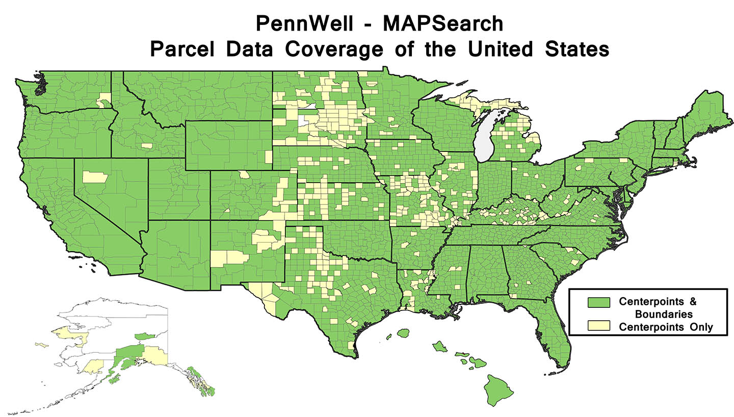
Parcel Data
CHOOSE A LICENSE THAT BEST FITS YOUR NEEDS
As the trusted industry source, we have listened to our clients and adapted to their needs and budgets
MAPSearch provides the most value for your GIS dollar. Our product bundles offer you flexible choices at reasonable prices. Sold by state, region, or all of North America–we are happy to learn what license best fits your needs.
To learn more about pricing, our basic and premium packages, and about our product– email sales@mapsearch.com.
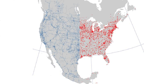
ELECTRIC POWER GIS DATA
MAPSearch has completely rebuilt our previous North American Power GIS data set to bring you the most spatially accurate and up-to-date electrical power infrastructure database available.
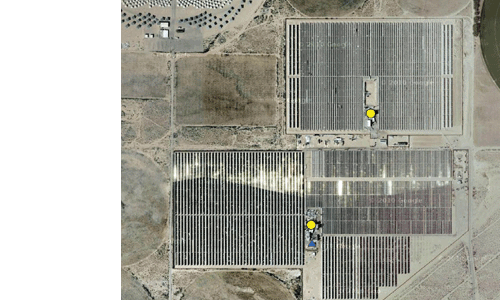
Using the latest satellite and aerial sub meter imagery, MAPSearch’s next generation (Version 1.0) electric power database gives you precise locations with accurate attribute data on a scale never before possible. Combined with MAPSearch’s industry leading petroleum and natural gas GIS infrastructure data, this new electric power solution makes our energy data toolkit the most comprehensive and accurate anywhere.
Why Do I Need This?
- Use this information for planning, comparative analysis, project feasibility analysis and risk evaluation.
- Examine the geographic relationships among the various data components to identify new opportunities.
- Incorporate additional layers and proprietary information to increase analytical value.
- Create powerful visual presentations for project reporting.
Primary Package Includes:
- PLANTS (Power plants & Hydros): Plant information includes plant name, status, nameplate capacity, year installed, number of units, primary fuel, secondary fuel, primary mover, owner/operator, spatial accuracy metacode; dam information includes dam name, reservoir name, ownership, size code, max capacity, normal capacity, surface capacity, HUC, river name, year completed
- XMISSION (Transmission Lines): Thousands of miles of transmission lines in North America; includes voltage, voltage range, line type, status, owner/operator, spatial accuracy metacode, transmission lines (down to the 33kV level)
- SUBS (Substations): Thousands of substations; includes substation name, type, status, owner/operator name, spatial accuracy metacod
Additional Layers:
- REA (Rural Electric Areas): Polygons representing REA owner, including number of consumers
- IOU (Investor Owned Utilities): IOU polygons representing IOU operating companies, includes owner/operator, number of customers
- MUNI (Municipalities): Polygons representing municipalities, includes owner/operator, MWH sales, number of customers
- NERC (NERC Regions): Region name, industry abbreviation
For the complete electric power product sheet, click here.
For pricing and further questions, email sales@mapsearch.com
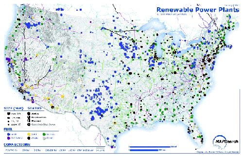
RENEWABLE ENERGY GIS DATA
Power generation has grown by nearly 50% in the last decade, but power companies are not utilizing the opportunity to evaluate other forms of fuel sources. With MAPSearch GIS data covering renewable energy generation and transmission, your company can be on the front line of tapping into these exciting new fuel sources.
Our MAPSearch team has completely organized and spatially adjusted our electric power infrastructure to include precise locations of Renewable Energy sources, as well as the most accurate attribute data. MAPSearch has utlized the latest satellite and aerial sub meter imagery to most accurately place our renewable generation and transmission to assist the need of utilizing new forms of power generation.
The location of renewable energy plants is just the beginning, while the location of transmission lines causes renewable energy to become a reality. MAPSearch data gives clients the most precise locations of how this power can be transmitted. Our data’s precision of transmission lines is unmatched in the industry; our renewable energy bundle is vital to any company taking advantage of renewable energy.
Primary Package Includes:
- GENERATION PLANTS WITH RENEWABLE FUEL SOURCES: Biomass, Geothermal, Hydro, Solar, Waste and Wind Plant name, owner/operator, number of units, name plate capacity, year installed and more.
- XMISSION (Transmission Lines): XMISSION (Transmission Lines)
Miles of transmission lines in North America; includes voltage, line type, status, owner/operator, spatial accuracy metacode, transmission lines. (down to the 33kV level) - SUBS (Substations): Thousands of substations; includes substation name, state, AC or DC, status, owner/operator name, spatial accuracy metacode.
Ideal For:
- Project Developers
- Electric Utilities
- Renewable Initiatives
- Wholesale Generators
- Contractors
- Engineers
- Federal, state and local agencies
For the complete renewable energy product sheet, click here.
For pricing and further questions, email sales@mapsearch.com