DIGITAL DATA FOR GIS
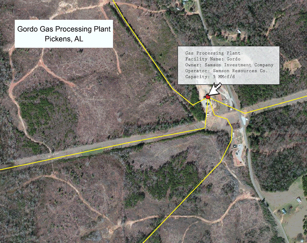
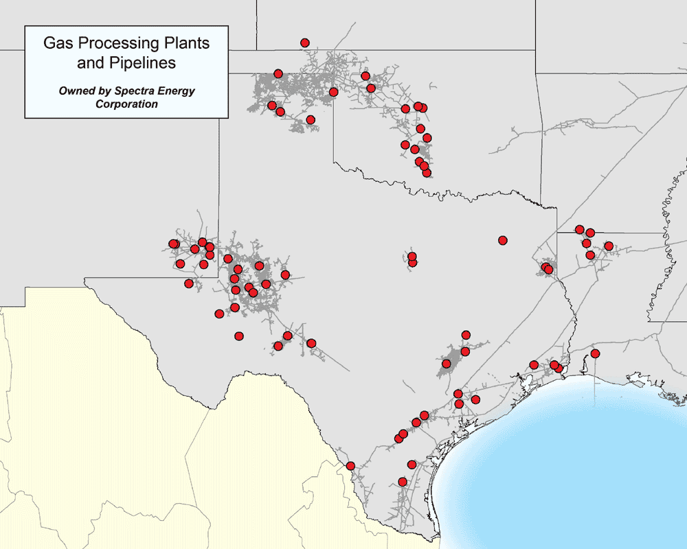
GAS PROCESSING PLANTS
MAPSearch’s North American Petroleum and Natural Gas GIS datasets offers full coverage of Gas Processing Plants.
Gas processing plants are used to purify the raw natural gas extracted from underground gas fields and condition it for storage or long-haul transport. Processed natural gas is almost pure methane, and is very much different from raw natural gas. Gas liquids are removed and transported away via truck, rail, or pipeline.
As a client of our petroleum or natural gas dataset, you will receive:
- The location of all gas processing plants within your licensed area
- Detailed attribute information for each plant, including:
- Name of the gas processing plant
- Owner
- Operator
- Last owner
- Last Operator
- Number of owners
- Lease status
- Primary Commodity
- Capacity
- Affiliation with gathering system
- Transparent details for the quality of data provided:
- When the attributes of the plant were last updated
- When the plant was last spatially adjusted using aerial imagery
- When the data was released (how current the information is)
- The source map for the information, and the source map’s resolution