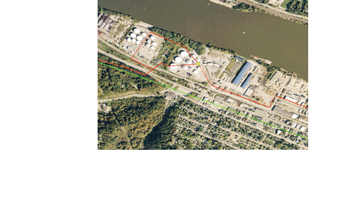
pipeline GIS DATA
Asset and Location Information = Competitive Advantage. GIS (Geographic Information Systems) is virtual mapping for today’s world.
In the age of technology, paper maps are no longer the most reliable source for information involving the location of ever-changing infrastructure. By using digital data, this information is easily updated by our experienced GIS technicians, and is re-distributed to our clients on a quarterly basis.
With MAPSearch GIS data, clients can visualize information that reveals new relationships, patterns, and trends not visible with text-files, spreadsheets, or tabular databases.
MAPSearch GIS data shows not only the location of energy assets, but also valuable information about those assets--such as the owner, operator, last owner and operator, year installed, and more.
We offer four comprehensive datasets:
Petroleum
Natural Gas
Electric Power
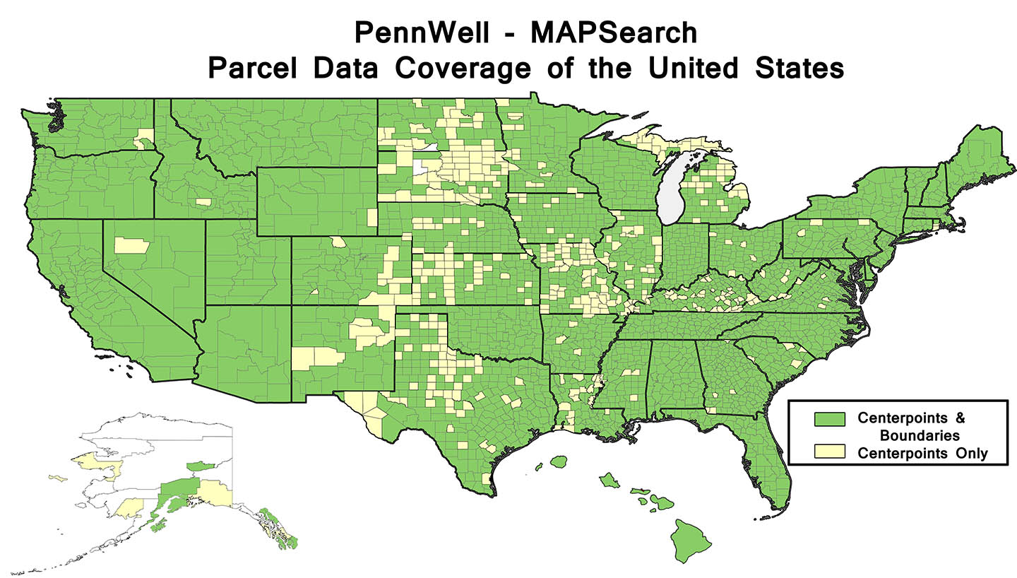
Parcel Data
CHOOSE A LICENSE THAT BEST FITS YOUR NEEDS
As the trusted industry source, we have listened to our clients and adapted to their needs and budgets
MAPSearch provides the most value for your GIS dollar. Our product bundles offer you flexible choices at reasonable prices. Sold by state, region, or all of North America–we are happy to learn what license best fits your needs.
To learn more about pricing, our basic and premium packages, and about our product– email sales@mapsearch.com.

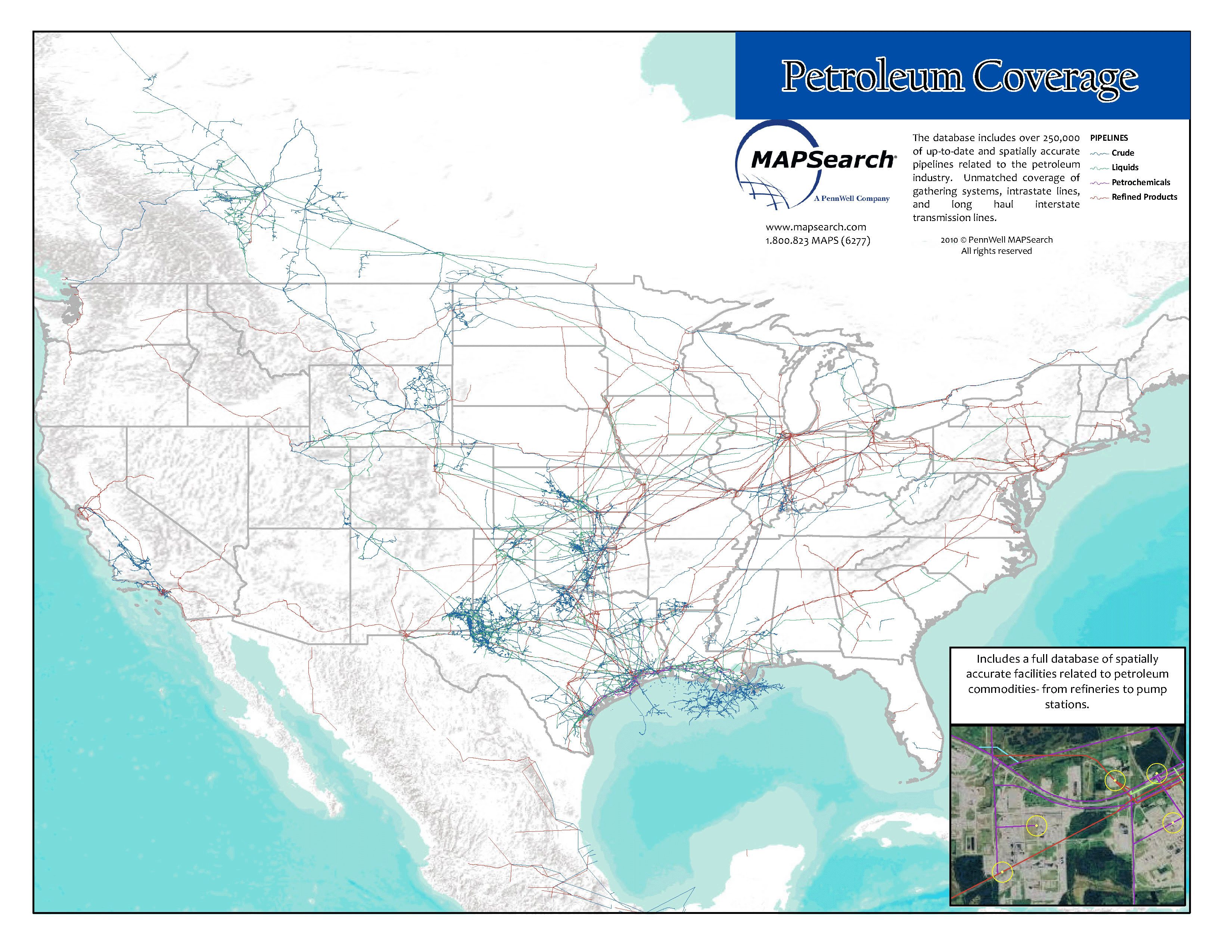
PETROLEUM GIS DATA
The North American pipeline GIS database for petroleum from MAPSearch contains pipelines and related facilities for all commodities associated with the North American oil industry:
- Crude oil
- Refined products
- Petrochemicals
- Gas liquids
- Specialty gases
Full coverage of all pipeline types: transmission, trunkline, and gathering. Extensive layers of facilities and interconnects, plus supplemental GIS layers.
Specific to the Petroleum Data, facility types include:
- Pump Stations
- Refineries
- Ethanol Plants
For a full list of facilities, click here.
Attribute data includes:
- Owner, Operator, Last Owner, Last Operator, Number of Owners, Lease Status
- Primary Commodity, Secondary Commodity, Commodity Batch Details
- Pipeline Type, Operating Status, Diameter, Direction of Flow, Affiliation with Gathering System
- Capacities for facilities
- Spatial and Attribute Update Dates, Source Map and Digital Imagery Metadata
For our complete petroleum product sheet, with more information on commodity coverage, facility types, supplemental data, and licensing, click here.
For pricing and further questions, email sales@mapsearch.com.

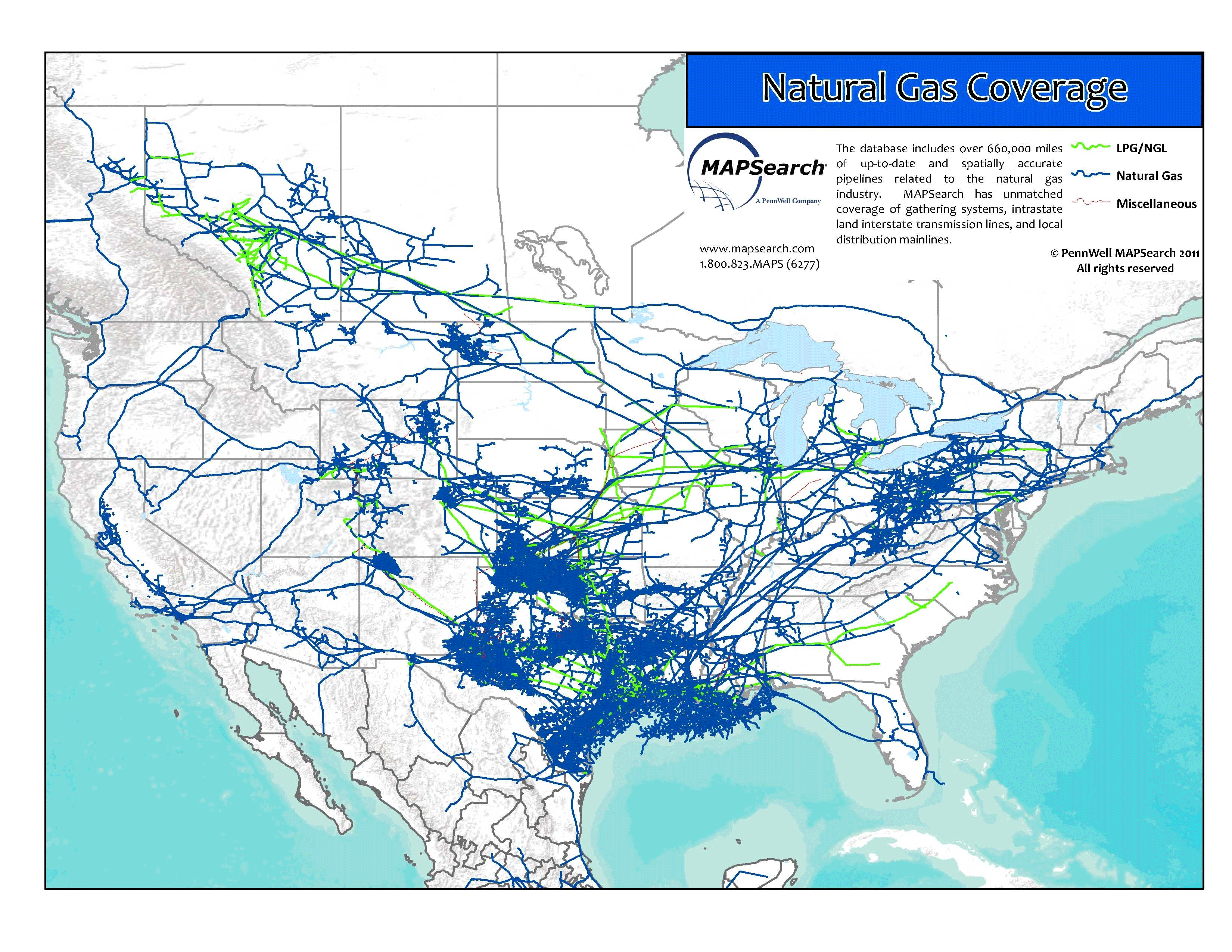
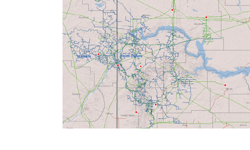
NATURAL GAS GIS DATA
The North American pipeline GIS database for natural gas from MAPSearch contains pipelines and related facilities for all commodities associated with the North American natural gas industry:
- Natural Gas
- Gas Liquids
- Specialty Gases
- LNG
Full coverage of all pipeline types: transmission, trunkline, and gathering. Extensive layers of facilities and interconnects, plus supplemental GIS layers.
Specific to the Natural Gas Data, facility types include:
- Bio gas production facilities
- Compressor Stations
- Fractionators
- LNG Terminals
- Natural Gas marketing hubs
For a full list of facilities, click here.
Attribute data includes:
- Owner, Operator, Last Owner, Last Operator, Number of Owners, Lease Status
- Primary Commodity, Secondary Commodity, Commodity Batch Details
- Pipeline Type, Operating Status, Diameter, Direction of Flow, Affiliation with Gathering System
- Capacities for facilities
- Spatial and Attribute Update Dates, Source Map and Digital Imagery Metadata
For our complete natural gas product sheet, with more information on commodity coverage, facility types, supplemental data, and licensing, click here.
For pricing and further questions, email sales@mapsearch.com.