DIGITAL DATA FOR GIS
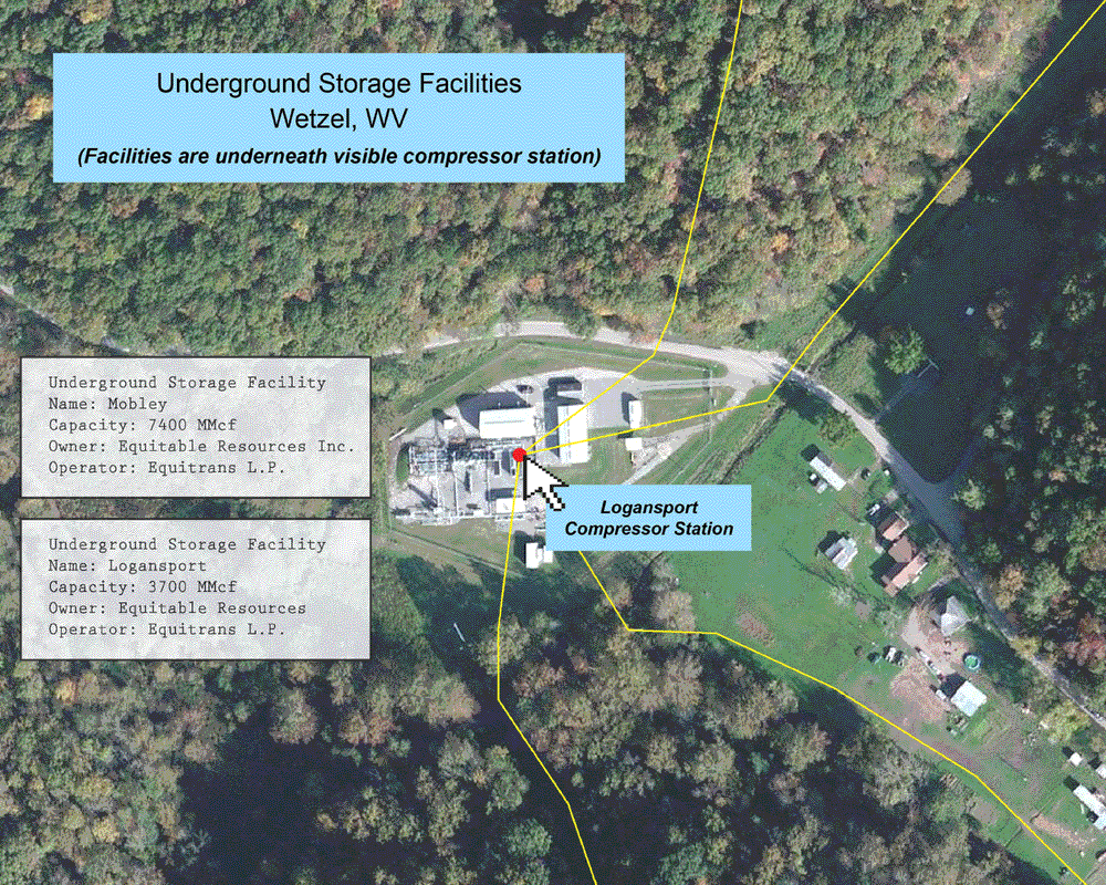
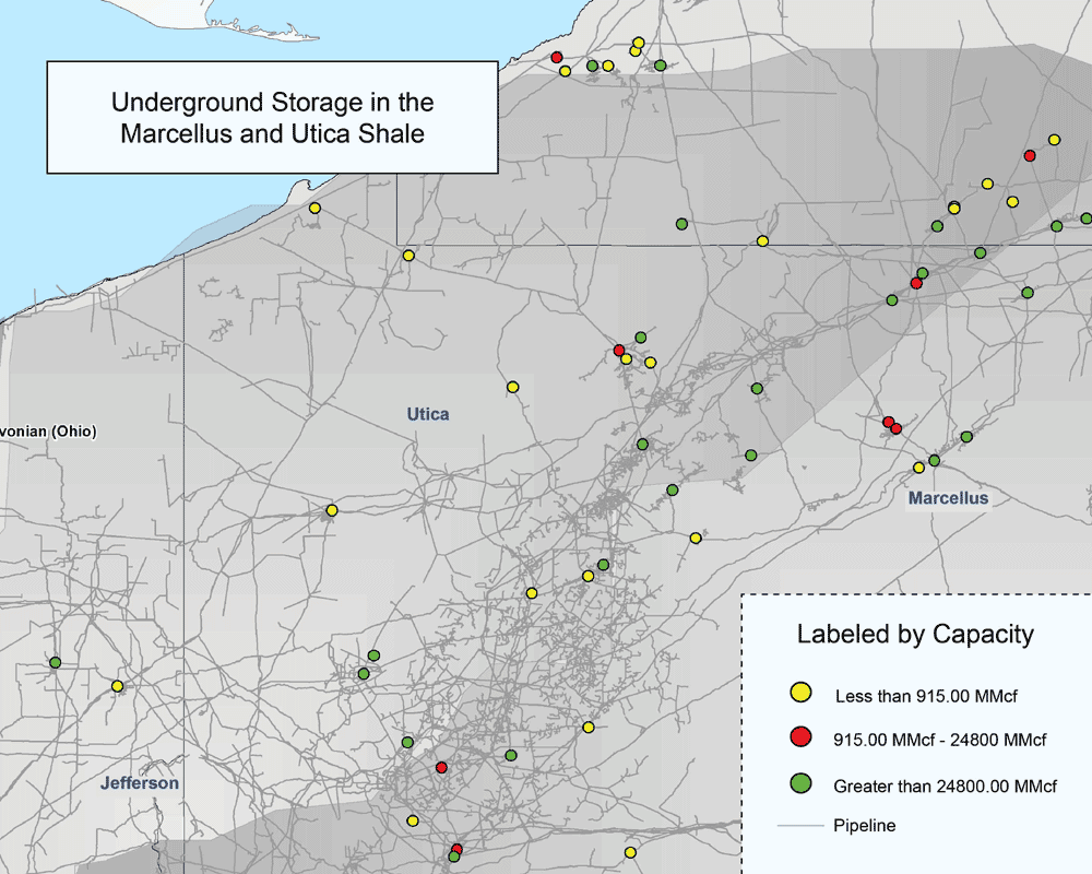
UNDERGROUND STORAGE FACILITIES
MAPSearch’s North American Petroleum and Natural Gas GIS datasets offers full coverage of Underground Storage Facilities.
Natural gas may be stored in a number of different ways. It is most commonly held in inventory underground, under pressure in either: a depleted reservoir and/or gas field, an aquifer, or salt dome cavern formation.
As a client of our petroleum or natural gas dataset, you will receive:
- The location of all underground storage facilities within your licensed area
- Detailed attribute information for each facility, including:
- Name of the underground storage facility
- Owner
- Operator
- Last owner
- Last Operator
- Number of owners
- Lease status
- Primary Commodity
- Capacity
- Affiliation with gathering system
- Transparent details for the quality of data provided:
- When the attributes of the plant were last updated
- When the plant was last spatially adjusted using aerial imagery
- When the data was released (how current the information is)
- The source map for the information, and the source map’s resolution