ENVISION PARCEL DATA
Parcel Data for ENVISION
Mapsearch provides the most reliable and cost-effective solution to all your data/mapping needs. Combining parcel data with our over 40-years of top-notch research and GIS operations, MAPSearch is the most comprehensive information provider for energy infrastructure available.
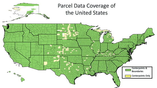
Our parcel data includes detailed ownership and polygon data for over 3,100 counties and over 150 million unique parcels in the USA.
Coverage: More than 99% of parcels in the U.S.
Why Do I Need This?
Parcel data can help you make informed decisions by providing the following information:
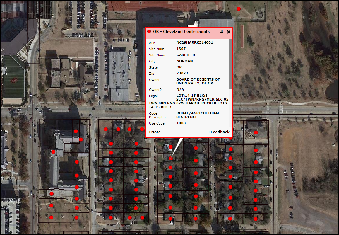
- Tax Number
- Property Lines
- Property Ownership
Possible Uses Includes:
Public Sector
- Administration
- Zoning
- Environmental: lake and stream erosion control
- City planning and design
- Construction of roads and public works
- Locating (Geocoding)
- Reverse 911
- Hazardous waste disclosure
Private Sector
- Real estate searching and visualization
- Insurance risk determination
- Infrastructure planning
- Railroad planning
- Utility planning
- Building and site development
- Locating (geocoding)
- Retail site selection
- Telecom planning
Attributes:
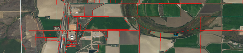
- Parcel boundary
- Parcel centroid
- APN or tax ID number
- Site Address Information
- Ownership Information
Pricing:
Parcel data is only available as an add on to our other data sets within ENvision, please contact Sales at sales@mapsearch.com for more details.

Parcel Buffer Tool