Oil & Gas Field Map of the United States, 2nd Edition
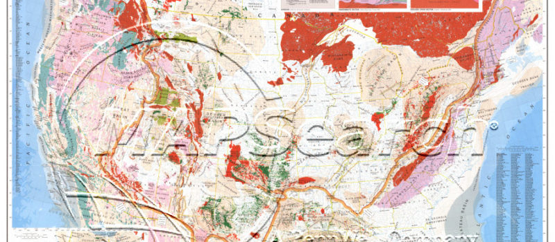
This detailed, industry-staple shows names & delineation, tectonics, contours, salt domes and other major geological structures; with color tints outlining the major basins and overthrust belts, precambrian rock limits, and indications of all major geological structures. Basic data includes: latitude lines, water depth, river systems, major cities, and an Alaska inset. Also: major oil & gas trend areas, rift areas, volcanic rocks & volcanoes, CO fields, and Gilsonite deposits. The geologic cross section of Eastern & Western Overthrust Belts is also shown– as well as, the Louisiana Gulf Coast region & California.
1985/ $199/ 40″ x 57″/ 1″ = 56.7 mi
No returns or exchanges.
