Iraq and Kuwait Energy Infrastructure Map
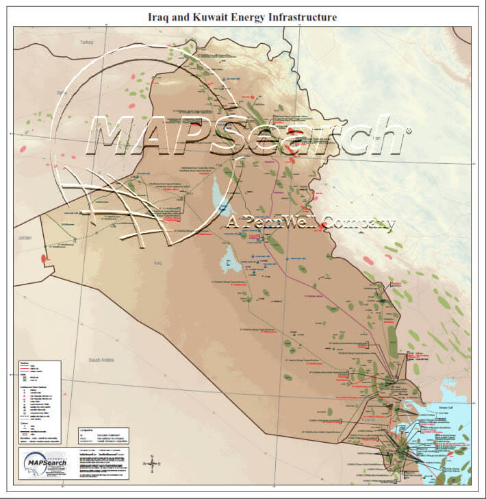
This full-color, topographic map shows crude oil and natural gas fields for Iraq, Kuwait and the northern Gulf. More than 10,000 kilometers of pipelines include: crude, natural gas, and refined products—all labelled with owner and status. Over 60 facilities include: refineries, chemical plants, gas plants with LPG, gas plants with NGL, power plants, import/export/dock facilities, storage/tank farm/terminals, industrial parks, and compressor/pump stations. This detailed reference map contains the latest information available for the region and incorporates data, additions, and edits from current interim (Iraqi petroleum and power officials).
Paper: Oct-03 / $275 / 36″ x 37″/ 1″ = 19.45 mi
CD: MS109CD/ $275
No returns or exchanges.
