OFFSHORE GULF OF MEXICO PIPELINE MAP
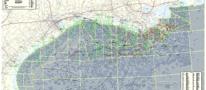
This descriptive map contains over 14,000 miles of offshore transmission pipeline–all labeled with diameter and ownership; as well as color-coded by commodity. Features include all major onshore/offshore connections (complete with labeled onshore connection facility), numbered lease blocks, and active lease blocks (color-coded and labeled with ownership). Gulf Coast onshore pipeline and facility locations are also included (represented as grayed-out symbols). Other onshore information includes: counties/parishes, cities, major water bodies, interstate highways, and major metropolitan areas.
9/01/ $295/ 76″ x 45″ / 1″ = 9 mi
No returns or exchanges.
