PETROLEUM GIS DATA

PETROLEUM GIS DATA
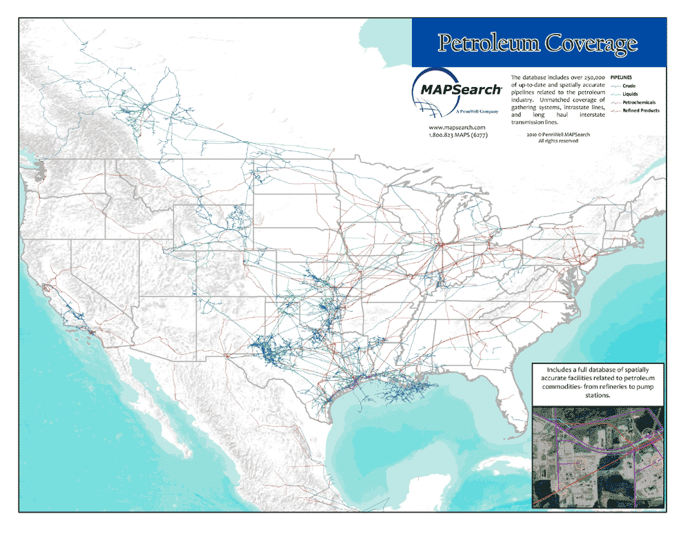
The North American pipeline GIS database for petroleum from MAPSearch contains pipelines and related facilities for all commodities associated with the North American oil industry:
- Crude oil
- Refined products
- Petrochemicals
- Gas liquids
- Specialty gases
Full coverage of all pipeline types: transmission, trunkline, and gathering. Extensive layers of facilities and interconnects, plus supplemental GIS layers.
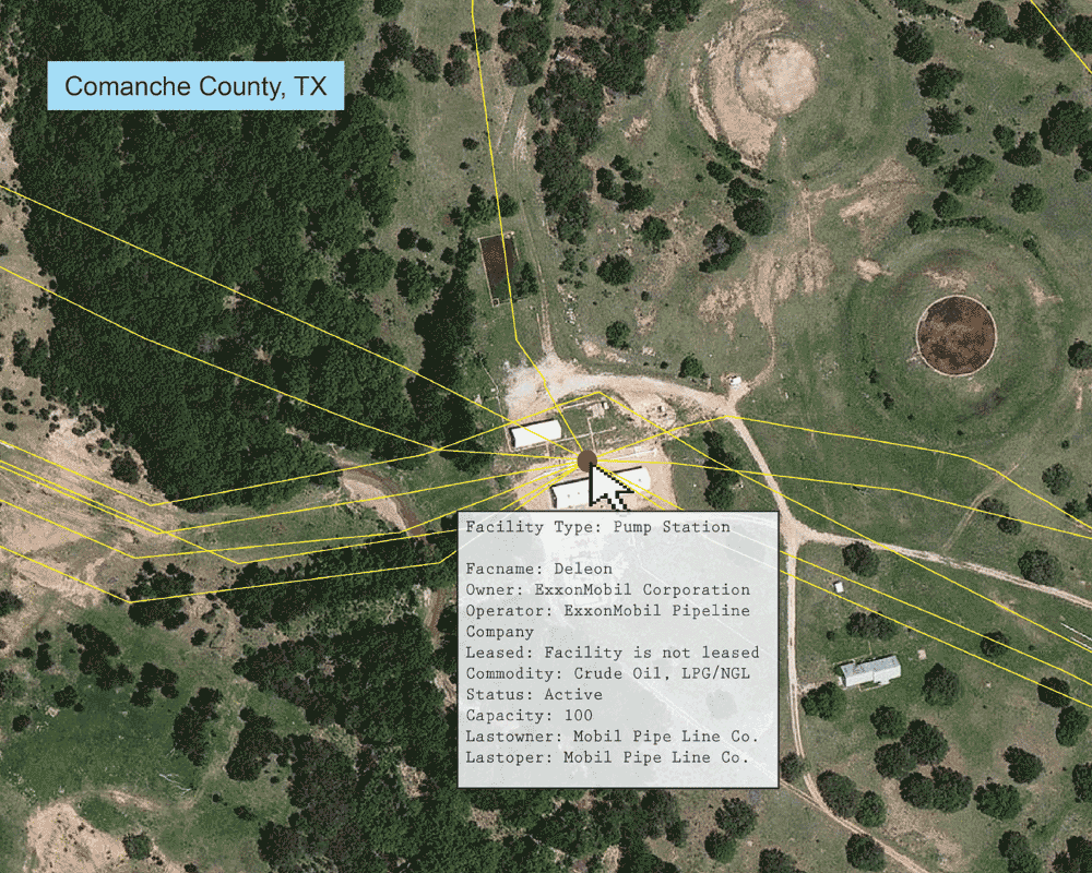
Specific to the Petroleum Data, facility types include:
- Carbon Capture and Storage
- Chemical Plants
- CO2 Processing Plants
- Crude Oil Rail Terminals
- Delivery Points to Industrial and Power Plants
- Distribution/Receiving Terminals
- Ethanol Plants
- Gas Processing Plants
- Import/Export/Dock Facilities
- Meter Stations
- Offshore Platform Structures
- Pump Stations
- Refineries
- Storage/Tank Farm/Terminals
- Truck Unloading Facilities
- Underground Storage
- Wellhead Meters
Attribute data includes:
- Owner, Operator, Last Owner, Last Operator, Number of Owners, Lease Status
- Primary Commodity, Secondary Commodity, Commodity Batch Details
- Pipeline Type, Operating Status, Diameter, Direction of Flow, Affiliation with Gathering System
- Capacities for facilities
- Spatial and Attribute Update Dates, Source Map and Digital Imagery Metadata
For our complete petroleum product sheet, with more information on commodity coverage, facility types, supplemental data, and licensing, click here.
Email us for pricing, sample data, or further questions: sales@mapsearch.com